Ute Bill Thompson
John Wesley Powell about the time of his Longs Peak ascent

Transportation

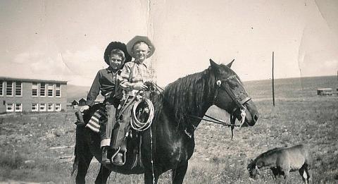
How did people travel to Grand County? How did they get around? Click on the drop-down menus and take a little trip through history.

Browse Subtopics

Transportation Articles

Getting Around in North Park

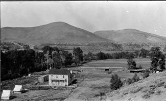
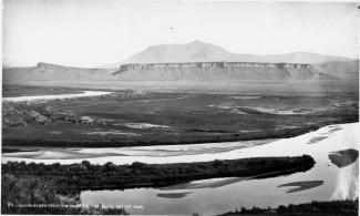
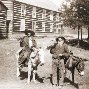
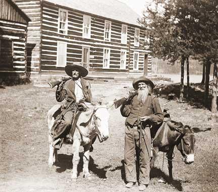
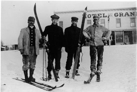
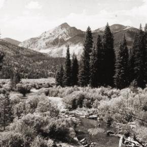
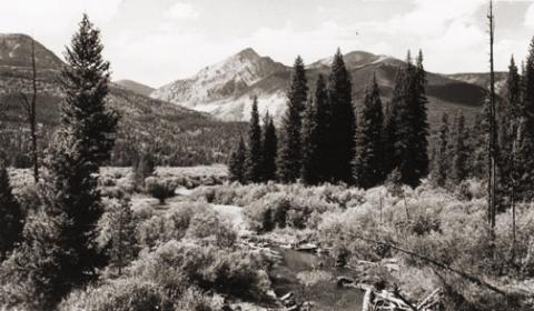
United States Geologist F.V. Hayden visited North Park briefly in August, 1868 in company of a small party of Army officers from Fort Saunders.  The campsite he described on the Big Laramie River is where the Boswell Ranch was later established.  They crossed the river at that point and entered North Park after following the Cherokee Trail twenty-five miles.  The trail from Boswell angled across Beaver Creek and Bear Creek to Chimney Park and then turned southwest to the neck of the Park.  It became North Park's main connection to the outside world.

In 1879, the year of the great fires, naturalist George Grinnell hired a teamster with a stout team and a Studebaker wagon to take him to North Park from Laramie.  By then wagon trails were numerous in the Park, probably created by market hunters who, in turn, likely followed travois-trails made by Indians.

Stagecoach service between Laramie and North Park started in May, 1881 with tri-weekly trips by Concord coach to mining community of Teller City.  The scheduled time for the trip was fifteen hours without any stoppage except for meals and to change horses.

After the mining activity at Teller slowed down the stages ran from Laramie to Walden.  Travel time was about twelve hours with three drivers on the route and five changes of horses, coming and going.

The Laramie-Walden stage had the best record for continuous service of any in the west in 1907.  At that time the mail had been carried six days each week for more than six years without missing a trip, although weather and roads had sometimes delayed the arrival of the stage until 2 or 3 in the morning.

That is a remarkable record considering the weather conditions the stage traveled in.  The editor of the Walden newspaper once described the Laramie Plains as a place "where the wind blows 400 days out of the year--sometimes with a speed and force that turns over wagons and miles of barbed wire fence."  During the winter months the stage would typically start from Laramie with a coach with wheels, transfer to a coach with sled runners at a point above Boswell when the snow got deep, and then transfer back to a coach with wheels when the snow ran out in North Park.

North Park had a public transportation system a century ago.  From Walden local stages carried the mail to the various post offices scattered around the Park.  Passengers could ride on the mail stages, so a traveler could get off the train in Laramie or Granby, take the stage to Walden and the next day catch a ride with the local mail stage to any place in the Park mail was delivered.

During the winter months local travel was by team and sled, skis or snowshoes. Willow Creek Pass became an important travel route for North Park after the Moffat Railroad reached Hot Sulphur Springs in the fall of 1905.  Dave Gresham established a road ranch for travelers near the top of the Pass.  J.W. Welch, the Rand merchant, soon had two freight outfits running between Rand and Granby and tri-weekly stagecoach service between Walden and Granby started in the spring of 1908.  Passengers left Walden at 6 a.m., spent the night at the Nixon cabins on Willow Creek Pass, and arrived in Granby at 11 a.m. the next morning.

Wagon loads of oats from the Yampa Valley were freighted into the Park over Buffalo Pass.  Construction of a road over Rabbit Ears Pass was still several years away.  Cameron Pass was a major transportation route in the days when Teller City was booming.  By 1879 it was obvious that the Park would soon be settled and Fort Collins businessmen were urging that a road to North Park be built to secure the travel and trade of the region before a trade route developed through Laramie.  A toll road was completed over Cameron Pass by 1881.  There was a charge of $2 for each vehicle drawn by one horse, ox or mule passing through the toll gate at Rustic.  A single span was $3 and any additional horses $1 each.  Business was brisk for only a few years and the road was opened to free public travel in 1902, but by then the public was using the road over Ute Pass and the road over Cameron Pass soon fell into a state of disrepair.

While a few automobiles ventured into North Park each summer, there is no mention in the early newspapers of anyone in North Park owning one of the contraptions by the spring of 1909.  There was one steam tractor in the Park and bicycles were popular.

Moffat Road
Moffat Road


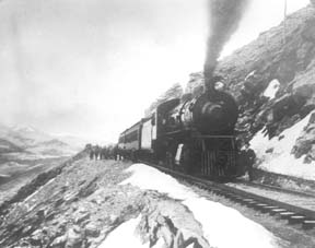
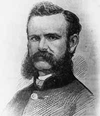
"I shall never forget it as long as I live. Nor do I ever expect to experience anything comparable to it again. Civilization had found its way across the mountains into Middle Park," reflected Mrs. Josephine Button in 1955 on her 91st birthday, as she recalled seeing smoke from the first Denver Northwestern and Pacific work-train on Rollins Pass, high above the Fraser Valley and Middle Park. Once those rails made it over the Continental Divide all the way to Hot Sulphur Springs, "changes came thick and fast." Many men, many dollars, many routes and many dreams tried to bring a railroad over the Continental Divide into Northwest Colorado, and the "Hill Route" over Rollins Pass that finally accomplished it a century ago has retained its allure ever since.

The Moffat Railroad built a cafeteria, telegraph station, living quarters for Moffat's "Hill Men" (as the railroad crews up there were known) and a fine hotel - all collectively called Corona Station. Soot-filled snow sheds protected over a mile of this windblown section of track. And where today silence is the most powerful sense, colorful locomotives pulled passenger and freight cars, filling the rare atmosphere with black smoke and mechanical clatter.

Decades of men's dreams lay behind the once massive snow shed that cut the bitter winds from the north and west, behind that fine hotel that offered some of the most spectacular scenery in America, behind the hopeful Town of Arrow nestled below tree-line ten or twelve miles west of Rollins Pass, and behind that first work-train that Josephine Button watched from her hay ranch along the Cottonwood Pass Wagon Road to Hot Sulphur Springs. Competent, often powerful, men in the 1860's through the 1890's filed surveys, graded road beds, and even began drilling before being stopped by severe storms that foiled the best laid plans or their inability to fund the ambitious projects.

Dreams to penetrate the high mountains along the Divide in central Colorado began when the Front Range was flooded with miners during the Gold Rush of 1859. Even before Colorado became a territory in 1861, Golden City, just west of Denver along Clear Creek, recognized its potential as a gateway to the rich mineral resources of mountain towns like Central City, Black Hawk, and Georgetown. Golden City's ambitions went beyond becoming a mountain transportation hub, believing that with the right incentives, enthusiasms, and leadership, its location supported a future as a national commerce center. 

Golden City certainly had men of vision, ambition, and wealth among its ranks. William Loveland and George Vest, both young and feverishly ambitious to see Golden City reach its potential, vigorously pursued their dreams for a powerful commercial center in Golden City. From Missouri River towns like Leavenworth in Eastern Kansas, leading town founders also recognized the benefits of linking their water and rail routes to the east with the resources of the west. Finally, as if destiny had demanded it, Edward L. Berthoud, a young civil engineer and surveyor with energy and ability, arrived in Golden City from Leavenworth in April of 1860 to unite the similar passions of leading citizens from both locations.

From 1861 until 1866, Berthoud, Loveland and Vest focused on bringing a direct transcontinental railroad route through Golden City. First, Edward Berthoud, along with Jim Bridger and a capable young cartographer named Redwood Fisher, blazed a trail across Berthoud Pass through Middle Park all the way to Salt Lake City. Returning to Golden City on May 28, 1861, Berthoud reported "a good wagon road could be ?quickly' built" from Denver to Salt Lake City over Berthoud Pass for about $100,000.00. According to the local hyperbole, a railroad would surely follow.

In spite of considerable enthusiasm, disappointment plagued early efforts to put a rail line over the mountains in Colorado Territory. In 1862, Territorial Governor John Evans sent the Surveyor General for Colorado and Territories along Berthoud's route and others to confirm or deny the potential of a railroad line. About the same time, the Union Pacific Railroad Company sent an independent reconnaissance to examine potential routes over the divide that included Berthoud and Boulder Passes (Boulder Pass became Rollins Pass in the early 1870's, when John Quincy Adams Rollins built a toll road over it, and then Corona Pass when the Railroad crossed it). Surveyor General Case and the UP agreed that neither route offered much hope for a standard gauge railroad. The dream of a transcontinental line over the Continental Divide through central Colorado seemed to die with the UP surveyor's words, "I learned enough to satisfy myself that no railroad would - at least in our day - cross the mountains south of the Cache la Poudre..." 

Multiple failed attempts to bring a rail line over the Divide through Middle Park during the following decades strengthened the UP's "death sentence." Against the odds, Berthoud and Loveland continued to solicit support for a railroad west over or through the Continental Divide, using improved surveys and maps to support their requests. In the 1880's, survey crews from a variety of railway incorporations were scattered over the high country on or near Rollins Pass. Over Berthoud, Rollins and other passes, they marked potential railroad lines with their wooden stakes. It was during this stretch of strenuous surveying activity that David Moffat, a highly successful Denver capitalist, got involved with an unsuccessful effort to bring through the mountains instead of over the top. 

 In the early 1880's, Mr. Moffat invested in the Denver, Utah and Pacific Railroad, which intended to tunnel through the mountains near Rollins Pass. Like the other efforts, though, the Denver, Utah and Pacific vanished in a few short years. Unlike many other lines that accomplished little more than surveys and maps, the DU&PRR completed significant grading and began tunneling before reaching the "end of its resources."

Money, power and success supported Moffat's dream to put Denver on a direct transcontinental railroad line. Doctor Robert C. Black, III, wrote that David Moffat's failed efforts in the early 1880's converted him to the idea that Denver needed to be on a direct transcontinental rail line. Moffat considered the route over Rollins Pass valuable enough to have surveying and grading crews working on it throughout the winter in 1902. The Denver Rocky Mountain News claimed that Moffat's route through Northwestern Colorado included "the largest strip of fertile land as yet undeveloped in the United States..." With his Denver, Northwestern and Pacific Railroad, David Moffat planned to make good his intentions to put Denver on direct transcontinental railroad line.

Moffat's original plan called for the "Hill Route" over Corona Pass ? the name changed from Rollins Pass in honor of Corona Station at the top ? to last for only a few short years. While the "temporary" route over the top generated resources by extracting the resources of Northwestern Colorado, a tunnel was to be bored through the Continental Divide. Even the wealth and power of Moffat, though, failed to adequately finance the tunnel before he died in 1911. The temporary line, therefore, lasted for nearly of a quarter century, from 1904 until 1928.

Its obstacles proved as enormous as the mountains it crossed. Work crews had to cease operations because of snow for most of April in 1920. The road was closed from late January until May in 1921. In December of 1924, engine number 210 busted "a main reservoir pipe," causing the train to fly down the hill out of control until it jumped the tracks and crashed into the valley below. Clearly, the Denver and Salt Lake Railroad, which took over Moffat's DNW&P after his death, needed a tunnel to replace the expensive effort over the "Devil's Backbone."

 As Denver and Salt Lake Locomotive Number 120 came through the tunnel in early 1928, it represented the culmination of a massive undertaking through wet, unstable rocks which required considerable engineering ingenuity and caused six deaths in a 1926 cave-in. It also took an enormous amount of coordination and effort to secure the necessary funding. Through local bond issues, private investors and other means, the project was completed. And through a connection at Dotsero, a railroad station less than 30 minutes west of Vail on I-70, freight and passengers could make a direct Pacific connection from Denver. Posthumously, David Moffat's dream became a reality.

For significant periods of time since the trains stopped operations over Rollins Pass in the late 1920's with the opening of the Moffat Tunnel, on-road vehicles crept along its relatively easy grades and wide curves from Rollinsville on the east slope to Winter Park on the west side of the Divide. Like now, the road ran through an area attractive to backcountry campers and sport enthusiasts. On September 1, 1956, local officials and private citizens met on Rollins Pass to celebrate a "joint state-federal-county project to convert the old D. & S. L. railroad right of way over Corona Pass into an access road for sportsmen." According to the Denver Post, the game and fish department's construction division reconstructed the road during the summer of 1955 for about $20,000. The following year, the road became a scenic route over the Continental Divide for family cars and jeep caravans alike. And after it was built, or at least reconstructed, they did come. Intrepid tourists into Middle Park.

Railroads
Railroads

Construction on the railroad line from Denver to Grand County began in July 1902.

The project, called the Moffat road (officially the Denver, Northwestern & Pacific), was the seemingly impossible dream of David H. Moffat, who spent much of his personal fortune building the tracks over the Continental Divide.

The rails pushed higher and higher up the mountains until they reached a station named Corona, meaning the crown of the continent.

Corona was the highest point in the world with a standard gauge railroad and the journey from Denver in the winter was perilous at best.

Huge snowplows were required on either side of the Divide to keep the tracks clear.

Eventually, in the late 1920s, a tunnel was dug through the range, eliminating 22.84 miles of track and the breathtaking journey over Rollins Pass.

The railroad reached Granby and Hot Sulphur Springs in 1905 and Kremmling in 1906, and played a significant role in building the population of Grand County.

In 1900 the total resident population of Grand County was only 741, but grew to 1,862 in 1910.

Stage and Freight Lines

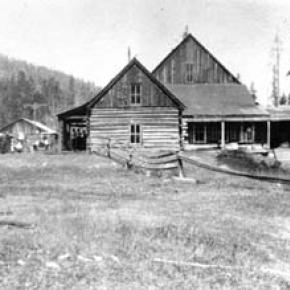
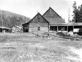
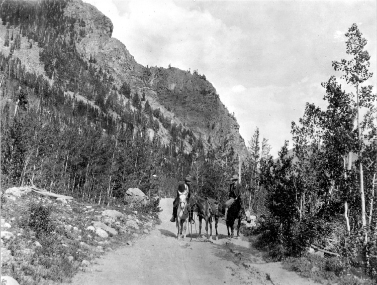
Berthoud Pass Stage Road was built by the extreme efforts of Captain Lewis Gaskill.  It came from the top of the Pass through Spruce Lodge, Idlewild (now Winter Park), the Cozens Ranch (near Fraser) Junction Ranch (Tabernash) and Coulter.  From there once branch lead over Cottonwood Divide to Hot Sulphur Springs (and points west) while the other went to Selak’s and over Coffey Divide to the Lehman Post Office and on to Grand Lake.  

At the summit of Berthoud Pass there was a large house of hewn logs, occupied by Lewis Gaskill and his family.  They collected the tolls for the road and gave welcome shelter to those weathering the variable passage.  The house was located on the West side of current Hwy. 40 but no trace of the building remains.  

At the steepest portion of the west side of Berthoud Pass was the Spruce House rest stop, which by 1900 was a sold structure of two and a half stories.  There the traveler could find a warm meal and corral for livestock.  No trace of it remains today.  

The Idlewild Stage Stop was located in present day Winter Park and was a popular place to change horses before the steep assent up the pass.  Mrs. Ed Evans served a hearty noonday meal there for only 35 cents.

Cozens Ranch was also one of the more popular stops and Fraser Post Office until 1904. Built around 1874 by William Zane Cozens, it remains today, outfitted in period décor and is the home of the Cozens Ranch History Museum.  

The Gaskill House, in Fraser was built by Lewis De Witt Clinton Gaskill, one of the original investors in the road and a prominent Grand County citizen. The house now houses the Hungry Bear Restaurant.

Junction House at Junction Ranch (Tabernash) could accommodate up to fifty travelers and was built by Quincy Adams Rollins, and subsequently leased to Johnson Turner.   

The Coulter Stage Stop was built by John Coulter, an attorney from George town and shareholder in the stage road.  It also served as a Post Office from 1884 to 1905. 

Frank and Fred Selak, sons of a pioneer Georgetown brewer ran the Selak stop which was north of Granby and east of current Hwy. 34.           

Cottonwood Divide (Pass), at 8904 feet above sea level, was laid out by Edward Berthoud and Redwood Fisher in 1861.  The route was used by stagecoaches from 1874 until the railroad arrived at Hot Sulphur Springs in 1905.  The last driver on the route was Charlie Purcell.  Summer travel time between Hot Sulphur Springs and Georgetown was typically twelve hours. Travelers between Hot Sulphur Springs and Kremmling could stop at the Barney Day or King Ranches, both near current Hwy. 40.   The Pinney Ranch House, used by the firm of Whipple and Metcalf for the connecting service to Steamboat Springs, is still standing on Hwy. 134 on the east slope of Gore Pass. There a traveler could pay 50 cents for a meal, 50 cents for a bed and expect a change of horses every ten miles.  It ceased operation in 1908 when the railroad reached Toponas.  

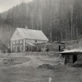
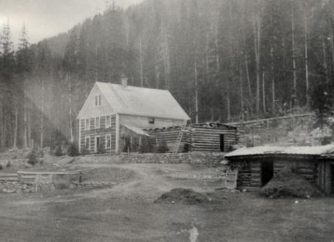
The flood that built the Moffat Tunnel

Article contributed by Tim Nicklas


For many years Denver longed for its own direct line through the continental divide, linking the city to the west coast.  In the 1860s, Denver was slighted by the Union Pacific(UP), when the company chose Cheyenne as the major hub for the prized Transcontinental Railroad, before it snaked through the Rockies.  Fortunately, the city fathers of Denver did not give up on making their city the center of the Rocky Mountain Empire, as they risked financial disaster by bankrolling a spur line to the main route in Cheyenne.  Denver may not have had their direct route to the west and the fortunes that lay on the other side of the divide, but the city was not dead. 


For Grand County, the U.P.'s decision not to penetrate the formidable barrier of Colorado's mountains had a much greater impact.  As it stood Grand County had no for seeable future of gaining a rail line.  This meant that the only means of transportation into or out of the county was by pack animal or foot.  Furthermore, without a line to Denver, there was virtually no practical way for industry to develop in Grand County.


In 1904, Denver and Grand County's long awaited dream of a direct line through the mountains and on to Salt Lake City began to materialize.  The Moffat Railroad had risen over Corona Pass and descended into the Fraser Valley.  At the time Corona Pass was the highest rail pass in the world.  Along with this fact came the troubles of maintaining such a wonder.  The route was challenging to keep open in the summer with the violent storms that are prone at such a location.  In the winter the line would close all together.  Adding to the trouble of the unpredictable route was the fact that Colorado's economy of the 1870s was not the same in the early 20th century.


In the 1870s, much of Colorado's mineral wealth was centered directly west of Denver in Central City and Georgetown.  By 1880 many of those mines began to play out.  Furthermore, production shifted to the silver mines of Leadville and the Arkansas Valley.  As a result, rail traffic favored Pueblo over Denver.  Pueblo was situated on the plains as the Arkansas River exits from the mountains, eliminating the need for boring tunnels or climbing over arduous mountain passes.  In addition, Pueblo was close to the coalfields that were essential to power the locomotives.  Also, the city was the site of the largest steel mill west of the Mississippi, which supplied rails for the sprawling network.  Finally, Pueblo's smelters boomed when many others withered after the "Silver Panic" of 1893.  At the same time that depression gripped Colorado and silver was devalued, gold was discovered in Cripple Creek.  Within a few short years the new gold camp would become the world's largest producer.  As a result, nearby Pueblo would reap the benefits by converting from silver to gold, to become the smelting capitol of the nation.


By the early 20th century, Pueblo's status as an industrial powerhouse and rail center threatened Denver's status as Colorado's "first city."  This was even further evidenced by the "powers-that-be" in the northern part of the state being unable to convince the rest of Colorado to finance a tunnel under the continental divide west of Denver.  Time and again legislation that would fund the missing link between Denver and the western slope was defeated in the statehouse by those in southern Colorado who were content with their established web-link.  Barring a miracle, it looked as if Denver and Grand County would have to settle for the unreliable Moffat line over Corona Pass.  In 1921 that miracle would rush in, due to un-for-seen misfortune upon Colorado's "second city" in the south of the state. 


The spring of 1921 started as many do in Colorado, with a drought.  By June 1st the many farmers downstream in the Arkansas Valley feared disaster as crops withered with thirst.  On the 2nd day of June, the farmers got the relief of rain they eagerly wanted.  Unfortunately, the downpour continued until the formerly parched earth became like a sponge and the Arkansas River swelled.  The streets of Pueblo were ankle deep with water by nighttime.  Suddenly, with little warning, a torrent of water rushed from the upper Arkansas Valley toward the helpless "Steel City."  Pueblo's streets filled with water up to rooftops.  The unified rail-yard was ripped instantly.   Unfortunate train passengers were tossed unaware into the maddening grip of the Arkansas, unable to escape the iron coffins in which they were riding.  Families were stranded on roofs as row boats desperately searched for stranded victims.  As pungent water filled the business area with filth and debris, fires broke out.  Unable to do anything, citizens watched helplessly as fire and water consumed their city.  As the flood receded the Rocky Mountain News headline proclaimed "201 Bodies Found, Scores Lost, Pueblo Death Total, 500 To 1,500."  The Rocky Mountain News goes on to describe the scene from June 4th:

"All day long refugees, dazed, not knowing what to do, straggled

about the streets.  Mothers with babes in their arms, mothers

whose arms were empty, old men and women and people of every

description wandered about until gathered up and taken to Red

 Cross headquarters, where they were fed and allowed to rest."

The scene in Pueblo was like those witnessed in New Orleans after Hurricane Katrina or the notorious San Francisco Earthquake in 1906.


As Pueblo dried out in the days that followed, plans were immediately being drafted in the statehouse to assure that the devastated city would not befall a future wrath from the Arkansas River.  Seizing upon the opportunity presented by Pueblo's misery, interests in Denver, Grand County, and others in northern Colorado saw fit to take advantage.  As the discussion of flood control in the south dominated state legislation the notion of a tunnel under the continental divide west of Denver resurfaced.  According to Ubbelohde, Benson, and Smith's book, A Colorado History 8th Ed., a "special legislative session made history."  Attached to the act that created the Pueblo Conservancy District, northern lawmakers added the Moffat Tunnel Improvement District.  As a result of the passage of these two distinctly different special tax districts in a single signing by Governor Shoup, the long sought after western passage would be built.  With the tunnel Grand County would finally be open to the outside world by a year round and reliable link.


The building of the Moffat Tunnel was an enormous undertaking that cost several lives and injured even more workers.  Nonetheless, the tunnel from its inception has remained of vital importance to the Fraser Va

The Train Comes to Fraser

Article contributed by Tim Nicklas
 

A little over a hundred years ago the few residents of Fraser were awakened by a sound new to their town.  The railroad had finally arrived in 1904, just over 30 years after it had first debuted in Denver.  That same blaring horn, followed by the rumble of iron wheels on rails is waking up the good town-folk of the Fraser Valley today.  As the local Manifest has documented recently, many residents have long been annoyed by the noisy disruption the train makes as it announces its passing through town.  Additionally, parents of school children rushing to Fraser Elementary School in the morning can attest to the intrusive obstacle the slow moving behemoth becomes at in the morning.

A hundred years ago, residents of the Fraser Valley complained loudly of the intrusion of the iron horse on the tranquil lifestyle.  It has long been rumored that the course of the railroad was determined by an angry old timer by the name of Billy Cozens.  Cozens was a pioneer of the valley having homesteaded his ranch in the area in the early 1870s.  According to legend, when the engineers were surveying the route of the future Denver, Northwestern, and Pacific Railroad through the valley, Billy Cozens bullied the crewmen into the woods.  As the railmen would lay their flags for the roadbed, Cozens, an expert marksman, would shoot the markers out of the ground.  As the story goes, this was the reason the tracks were laid through the forest, rather than the meadow.

The reality of the chosen route for the D.N.&P. was due to grade and not fear of the rifle.  Whether Cozens despised the railroad is anyone's guess.  According to Robert Black's book, Island in the Rockies, the railroads designing engineers actually consulted Cozens concerning the lack of snow on the continental divide.  Regardless, the rumors have persisted over the years about the "Old Sheriff's" contempt for the railroad.  It has even divulged to me that the ghost of Billy Cozens will not allow anything concerning the railroad in his former home, the Cozens Ranch Museum.  Whenever railroad exhibits have been attempted they have mysteriously vanished and were never seen again.

As far as the townfolk of Fraser were concerned, many of them regarded the railroad as an opportunity that had eluded the region for years.  Unfortunately for Fraserites, their town was to be bypassed as the major hub for the area.  Further down the valley Tabernash was chosen as the location for the workshops and roundhouse for the forthcoming trains.  As a result, the trains would move through Fraser without their engineers paying the town much notice outside of their blowing whistles.  Nonetheless, the people of the valley would embrace the iron horse.  Economic potential in Grand County would erupt due to the advent of relatively efficient transportation.  Specifically, the lumber industry would boom with the outlet that the railroad would provide.  Additionally, people could move between Denver and Grand County easily compared to the wagon roads that formerly provided the only passage to the outside world.  As timber and cattle traveled to the Front Range, mail and hard goods traveled back to the Fraser Valley.

In years past, just like today, it has been easy to forget the benefits that the railroad has brought to our lives.  Certainly, when the train moved into the valley, the people that day realized that their life could slow down a bit.  The reality was that the short inconvenience that the passing train brought with its blaring horn, bringing traffic to a momentary standstill enhanced the life and character of the Fraser Valley.  It provided power, people, and materials in a unique way that simplified life here.  This is as true today as it was in 1905.      


Train Legends of the Moffat Road

Article contributed by Abbott Fay

The railroaders graded and bridged the trails originally made by the Indians and expanded by the trappers, prospector and stage road builders that following in rapid succession. The

Moffat Road
train track has an almost endless series of wreck stories and legends.  In one, a "green clerk" was said to have piled all the mail order catalogs on the same side of a car, causing the train to leave the tracks and roll down the mountainside into Yankee Doodle Lake.


In another lost train story, the No. 3 westbound was seven hours late out of Denver because of a severe winter blizzard.  It crept out of the Fraser Canyon and whistled for the Granby Crossing.  The engineer parked the train intending to wait till daylight to continue on.  In the meantime, the No. 2 eastbound, 2 days late out of Craig reached Corona without passing the No. 3. In the morning, all were amazed to find the train parked "plumb center" of Granby's main street. Later investigation showed that the No. 3 train left the train tracks just east of Granby and traveled almost a mile over frozen highway.  The next day a Chinook wind came up and melted the frozen soil, sinking the train to it's axles in mud. It required the building of 1500 feet of special track to salvage the train. However, some longtime Granby residents say the locale of this incident was the Kremmling flats.


Sources: Roland L. Ives, Folklore of Middle Park Colorado,Journal of American Folklore, Vol. XXXIV, Nos. 211, 212, 1941; Levette J. Davidson & Forrester Blake, Rocky Mountain Tales, University of Oklahoma Press, 1947
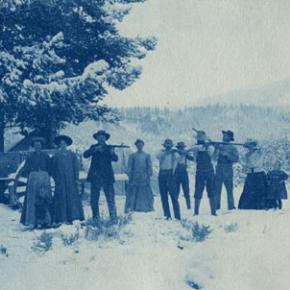
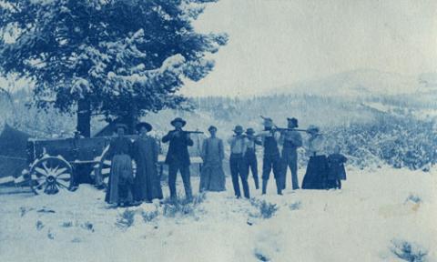
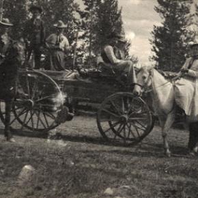
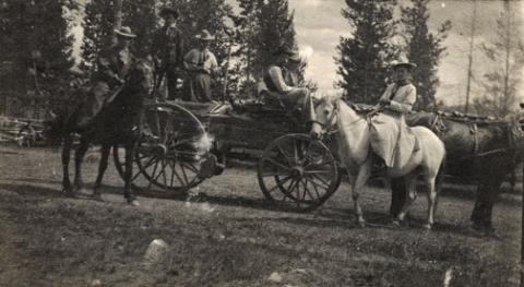


Wagons of the West
Wagons of the West

Transportation into Grand County in the late 1800's was one of the more difficult tasks. Stage coaches were used to carry the many people to and from the county.

The first stagecoach into Grand County was a Concord. The Concord stagecoach was a luxury wagon weighing around 2,200 lbs. It cost around $1,050 and was beautifully painted. No two Concord luxury coach paint jobs were the same. The wheels were made of white oak and would not shrink in the cold or expand in hot weather, and made very reliable, durable wheels. The body was iron barred and was easier for the horses to pull than some of the other standard stagecoaches of its time. The mountain conditions caused different rules and a different coach then the stereotypical Concord.

The inside of a Concord was four feet wide, and four and one half feet tall. The coach had leather curtains, but they did little to keep the dust, wind, snow, and rain out. Three benches lined the inside, and held nine passengers. The coach was often known to hold up to six people on the roof as well. Luggage was held in the "boot", a metal box on the back of the coach. Mail was often put in the "boot" for transportation, or kept right behind the driver.

The average speed for the Concord was around fifteen miles an hour. The braking system was sand bags placed over the brake pads, so that sand could be released on rugged hills. The Concord was only used for one year because of its weight and bulkiness it did not make for a good coach in the mountains. The weight, price, and bulkiness caused this stagecoach to be produced for one year before another one came into play.

At one third of the cost, the Dearborn took over after the Concord. These were known as Mud Wagons because of their easy travel in the mud and tricky terrain. The Mud Wagon weighed around 1,600 lbs. and was much more efficient. It had the standard four wheels, but was only pulled by one to two horses, and could hold around one to three people. However it was not as luxurious as the Concord. They often  did not have side curtains, and the seats were not as nice. The cabin sat on wooden springs. The Mud Wagon was used by farmers, peddlers, emigrants, and pleasure travelers as it was affordable and decent in appearance.

The weary traveler who took the stagecoaches soon learned the rules of the road. The best seat was next to the driver where there were less bumps. Never ride in cold weather with tight boots or shoes, or tight gloves. If one is asked to walk, do so without grumbling as the driver would not ask unless truly necessary. Don't jump from the moving wagon, as nine out of ten times you will get badly hurt. Do not drink alcohol in cold weather as it can cause hypothermia. In warm weather it is okay to drink as long as you are willing to share. Eat what is available, no one wants to hear you whine. Do not smoke, or spit on the leeward side. Never swear, and don't fall asleep on your neighbor. Do not ask how much longer, you will get there when you get there. Never fire a gun as it will scare the horses. Never grease your hair because of dust and most important - remember mountain traveling is hard.The first stagecoach into Grand County was a Concord. The Concord stagecoach was a luxury wagon weighing around 2,200 lbs. It cost around $1,050 and was beautifully painted. No two Concord luxury coach paint jobs were the same. The wheels were made of white oak and would not shrink in the cold or expand in hot weather, and made very reliable, durable wheels. The body was iron barred and was easier for the horses to pull than some of the other standard stagecoaches of its time. The mountain conditions caused different rules and a different coach then the stereotypical Concord.

The inside of a Concord was four feet wide, and four and one half feet tall. The coach had leather curtains, but they did little to keep the dust, wind, snow, and rain out. Three benches lined the inside, and held nine passengers. The coach was often known to hold up to six people on the roof as well. Luggage was held in the "boot", a metal box on the back of the coach. Mail was often put in the "boot" for transportation, or kept right behind the driver.

The average speed for the Concord was around fifteen miles an hour. The braking system was sand bags placed over the brake pads, so that sand could be released on rugged hills. The Concord was only used for one year because of its weight and bulkiness it did not make for a good coach in the mountains. The weight, price, and bulkiness caused this stagecoach to be produced for one year before another one came into play.

At one third of the cost, the Dearborn took over after the Concord. These were known as Mud Wagons because of their easy travel in the mud and tricky terrain. The Mud Wagon weighed around 1,600 lbs. and was much more efficient. It had the standard four wheels, but was only pulled by one to two horses, and could hold around one to three people. However it was not as luxurious as the Concord. They often  did not have side curtains, and the seats were not as nice. The cabin sat on wooden springs. The Mud Wagon was used by farmers, peddlers, emigrants, and pleasure travelers as it was affordable and decent in appearance.

The weary traveler who took the stagecoaches soon learned the rules of the road. The best seat was next to the driver where there were less bumps. Never ride in cold weather with tight boots or shoes, or tight gloves. If one is asked to walk, do so without grumbling as the driver would not ask unless truly necessary. Don't jump from the moving wagon, as nine out of ten times you will get badly hurt. Do not drink alcohol in cold weather as it can cause hypothermia. In warm weather it is okay to drink as long as you are willing to share. Eat what is available, no one wants to hear you whine. Do not smoke, or spit on the leeward side. Never swear, and don't fall asleep on your neighbor. Do not ask how much longer, you will get there when you get there. Never fire a gun as it will scare the horses. Never grease your hair because of dust and most important - remember mountain traveling is hard.

Articles to Browse

Topic: Mining
Mount Baker

Gaskill and the Wolverine and Ruby Mines

Mount Baker

The Wolverine Mine was discovered in 1875 by James Bourn and Alexander Campbell. Bourn was the brother-in-law of James Crawford, the founder of Steamboat Springs. James Bourn was the twin brother of Crawford's wife, Maggie.  A Grand County recording error forever changed the name of Bourn in the area to "Bowen".  The mine was located in the Rabbit Ears Range on Bowen Mountain, up Bowen Gulch, approximately 10 miles northwest of Grand Lake.  This discovery sparked additional exploration in the area that lead to a number of new mines. Within a week of the original discovery,  interested parties formed the Campbell Mining District which included Bowen Mountain, Bowen and Baker gulches.  Some of the Middle Park residents who participated in the mining exploration  were John Baker, Charles Royer, Charles Hook, John Stokes and the Redman brothers, William and Mann. The Redman's  eventually  discovered the Sedalia mine. Bourn and Campbell  in less than a year lost the Wolverine mine by not fulfilling a grubstake agreement with the Georgetown grocers, Spruance and Hutchinson.

John Stokes leased the Wolverine Mine from the grocers until Edward Phillip Weber, an agent representing a group of Illinois investors, purchased the Wolverine Mine in the Summer of 1879.  Weber continued purchasing other Campbell Mining District claims which created a great deal of local excitement.  Weber hired Stokes  to assist him and also hired Lewis Dewitt Clinton Gaskill to act as the first foreman for the Wolverine mine.  Gaskill had mine operation experience, having successfully operated the Saco Mine, on Leavenworth Mountain, above Georgetown for several years.  A mining camp was built  below the Wolverine Mine that contained a large bunk house building and a more substantial mine office building.

Gaskill, a Civil War veteran of the 28th  Regiment of the New York Volunteer Infantry,  had come to Colorado in 1868 as a representative of a group of Auburn, New York bankers to invest in mining properties.  He eventually successfully operated the Saco mine in 1873 and 1874.  He invested in the Georgetown, Empire and Middle Park Wagon Road in 1874, which was a toll road that finally made the Berthoud Pass road passable for wagon traffic.  Gaskill also acted as the foreman during the construction of the road. The principal investor in the road was William Cushman of the First National Bank of Georgetown. The bank had a financial collapse in 1877.  At that time, Gaskill was the secretary of the road company and lived with his family in the company house just below the summit of Berthoud Pass on the west side.  William Hamill, a wealthy Georgetown businessman, bought the wagon road in a foreclosure auction in 1881 for $7,000.  Gaskill continued to live with his family in the Berthoud Pass summit house until 1885, when he moved his family into the Fraser Valley and homesteaded 160 acres along Elk Creek.

The settlement of Gaskill began when  in August of 1880,  Al J. Warner built a log cabin store in a meadow below Bowen Gulch on the trail/road that lead to both Bowen Gulch and Baker Gulch.  The settlement was also strategically well placed midway on the trail/road between Grand Lake and Lulu City and the Lead Mountain Mining District.  Another store was built in September by  John K. Mowery.  By that October, Mowery was appointed as the first postmaster of Gaskill.  The following spring E. Snell, opened a large general merchandise store that prompted the original store keeper, Al Warner, to relocate to Grand Lake as Al's Place. The town was named to honor L.D.C. Gaskill, the greatly respected foreman of the Wolverine Mine, the road builder/operator and the Civil War veteran.  By 1882, the town covered 60 acres.  E.P. Weber of the Grand Lake Mining and Smelting Company got involved in the town real estate development by laying out a city grid and offering lots for sale.  Weber's plat renamed the town Auburn after L. D. C. Gaskill's home town of Auburn, New York, but the Gaskill name stuck.  By the close of 1882, there were over 100 residents living in Gaskill.  The most substantial building was the Rogerson House, a well appointed two  story, squared log hostelry, Horatio Bailey Rogerson, proprietor.  Rogerson, would be elected County Commissioner in November of 1882, but would not serve because of a sudden discovery of ineligibility.  Instead, lame duck Colorado Governor Pitkin, appointed E. P. Weber to the post.  Weber was killed in the infamous July 4, 1883 shoot-out at Grand Lake.   

The Bowen Gulch trail lead to many of the  most productive and worked mines in the Campbell Mining District which included the Wolverine, now owned by the Grand Lake Mining and Smelting Company, E. P. Weber superintendent and the Ruby and Cross mines owned by Kentucky and Colorado Mining and Smelting  Company, John Barbee superintendent. Barbee, who lived in Grand Lake,  would go on to serve as superintendent of schools, Justice of the Peace and briefly the editor of the Grand Lake Prospector.  Barbee's partner in many endeavors was Antelope Jack Warren. Warren was as rough as Barbee was refined.  He acted as a foreman and, by one account, a bodyguard for Barbee.  The Bowen Gulch trail continued up the mountain to Bowen Pass and then descended into North Park and the Jack and Park mining districts which were organized by the end of 1880, to the settlement of Teller City.  Passable roads that could handle wagon traffic were needed and often planned but rarely built.  The high cost of building and maintaining  wagon capable roads in Middle Park was a difficult proposition for local governments and private entrepreneurs.  

The Grand County Commissioners in July of 1877 had declared the trail from Grand Lake to the mining gulches of the Rabbit Ears  Range to be a county road.  However there was little county money to pay for improvements to make the trail a road.  Private investors were reluctant to invest in wagon roads when there was the persistent  rumor that railroads were coming spawned by the numerous railroad surveys that were performed in the area.   Albert Selak, a Georgetown brewer, in August of 1878, organized a toll road that would branch off of the Georgetown, Empire, and Middle Park Wagon Road at the Ostrander Ranch on Red Dirt Hill, and proceed to Grand Lake and continue on to the Rabbit Ears Range mines and continue on into North Park and on to the Wyoming territory line.  John Barbee invested in the Middle Park Toll Bridge Company, a toll bridge company that intended  to build a bridge across the Grand River  above the confluence of Willow Creek and the Grand River.  However, this project languished, and was taken over by the county with an expenditure of $150.  

If ore wagons would need to haul ore to the nearest reduction mill which was over 60 miles in Georgetown, the toll road might have been a financial success. However, the lower grade ore from these Rabbit Ears Range mines would not yield a sufficient profit to cover the transportation and processing costs in a market where the market value of silver annually declined.  So the ore piles grew.  What was needed was a nearby reduction mill or cheaper transportation, like a railroad or a higher price for silver.  Weber had  repeatedly promised that a reduction mill was coming, but nothing was ever built.  By April of 1883 with tons of ore piled up and waiting for transport to be processed,  Weber temporarily closed the Wolverine Mine and laid off his miners.  He admitted  in June of 1883 that the ore from the Wolverine was “rather refractory” and that it would not justify shipment without local reduction.  Some hoped the closing was a strategic move by Weber to trigger a sell off of area mining properties  so that he could acquire additional mines before he built the reduction mill, but it was not to be. Weber would soon be shot dead by his political rival, John Gillis Mills.

The favorable newspaper stories of Rabbit Ears Range mining would continue, but for the informed, it had become  clear that without a major investment in improved transportation including a railroad or a major investment in a reduction mill in the area, the mining concerns were doomed to fail.  Mining claims had to be worked in order to be kept.   A minimum of $100 of labor or $500 in improvements had to be expended each year to maintain the claim or else the claim would be deemed abandoned.  Many claim holders leased their claims to miners to work for a percentage of the return.  Without the ability to sell and process the ore for a profit, there was no return.  The speculative mining investment money began to dry up and the miners and their supporting merchants began to leave.  By the end of 1886, the Middle Park mining boom had  ended. To further add to the decline,  a border dispute that arose between Larimer County and Grand County over the taxation and mineral wealth of North Park was finally decided in 1886 by the Colorado Supreme Court in favor of Larimer County.  North Park was part of Larimer County, not part of Grand County.  A lawsuit would follow so that Larimer County could recover the wrongly collected taxes of $20,000 from Grand County.  Grand County's total tax income at the time was less than $3,500 a year.

Topic: Dude Ranches

Squeaky Bob's Hotel de Hardscrabble

Robert L. "Squeaky Bob" Wheeler homesteaded the northern end of the Kawuneeche Valley in 1907, setting up his tent camp at the base of Shipler Mountain.  He called his accommodations Squeaky Bob's Hotel de Hardscrabble.  He was one of many guest lodge operators who catered to the leisure traveler seeking relaxation through recreation.  These vacations were quite rustic, especially by today's standards. At least two guests at a time were asked to share lumpy beds. The sheets were said to be "refreshed" with talcum powder rather than changed and laundered.  The outhouses were stocked with mail order catalogs rather than toilet paper.

Despite these conditions, Squeaky Bob was very successful and his hotel hosted famous travelers from all over, including President Theodore Roosevelt. Squeaky Bob was known for entertaining his visitors with amazing tales and witty yarns.

Topic: Regions

Church Park

George Henry Church and his brother John had a substantial ranch in Jefferson Country, prior to Colorado Statehood.  When the Timber and Stone Act of 1878 was passed, it permitted the purchase of land unfit for agriculture for $2.50 an acre.  Thus the Church brothers obtained land in Middle Park for summer grazing.  They would move their cattle into the Park by driving them over the Rollins Pass.   The area they used is just west of the town of Fraser and became known as Church Park.

In 1910, the Church Ditch was created to divert water across the Continental Divide for irrigation.  The remains of this early trans-mountain project can still be seen today at mile marker 241.5 on U.S. Highway 40.

Joe on Melody, Joe and Dad in 4th of July Parade, Joe and Howard 4th of July Parade

4th of July Parades in Granby

Joe on Melody, Joe and Dad in 4th of July Parade, Joe and Howard 4th of July Parade

In 1947 my family moved to Granby, Colorado; I was 5 years old. My Mom (Eloise) and Dad (Howard, “RED”) Beakey, ran the Texaco gas station where the Chamber of Commerce parking lot now sits. I have a sister named Sandra Sue, who was 3 at the time.

In 1948 Mom and Dad bought me a mare named Midge, and that is the beginning of my joy of growing up in Granby. I rode Midge all over Granby and surrounding area. In the winter I would pull kids on their sleds and skis with a rope tied to the saddle horn. In the spring of 1949 Midge produced a filly foal that we named “Lady Blaze.” The following 4th of July Rodeo Parade, 1949, I rode on Midge and my friend, Howard Ferguson, rode behind me and led Lady Blaze in the parade. A local farrier had made lace up booties with metal bottoms for Lady Blaze so she wouldn’t damage her hooves while being led in the parade. You can imagine the sound of those booties hitting the pavement as we rode down Agate Ave., and the enjoyment of the crowd lining the parade route. At that time the rodeo grounds were in the area of N Ranch Road. The Granby Fire Department awarded me with a $3.00 check for being “The Most Typical Cowboy Under 12.”  I was totally amazed and still, at the age of 79, have that check!  I did give Howard $1.50 in cash, though, that day for his part.

The following year, 1950, Mom and Dad bought a Pinto filly from Tex Hill, the Foreman of the Little HO Ranch east of Granby. Tex rode the Pinto into the gas station office one day and asked my Dad if she was gentle enough for me. Dad said yes, and I became the proud owner of my second horse, which I named Melody. That year (1950) my sister, Sandra, rode Midge and my Dad rode his hunting horse, Spike, and I rode Melody in the Rodeo Parade. Prior to the rodeo Dad (who hadn’t ridden Spike in a long time) got bucked off into a pile of rocks and got pretty banged up. Sis rode up and asked Dad (who was laying on the rocks) “are you dead Daddy”?

Sis and I rode all over Grand County, riding along US 40 to 10 Mile Creek to fish the beaver ponds; we would be stopped several times to have our photos taken by the tourists. Tourists always seemed amazed to see little kids riding on horseback way out in the country.  We always brought home from our outings some nice Brookie trout. Sometimes we would ride out to The Little HO Ranch and spend a few days there with playing real live cowboys with Tex, while Sis would help his wife around the house.

In 1951 Tex Hill brought a full sister to Melody, named Patches, for Sis to ride in the parade, so, we rode side by side. That same year Eddie Linke Jr. asked me to ride his racehorse in the rodeo race. We went to the rodeo grounds several days for me to get used to the horse. Of course, the horse was not as gentle as Melody, so I fell off several times before getting use to him. The best part is that I did win the race, and was happy and proud riding Eddie’s horse.

In 1952 I once again rode Melody in the Rodeo Parade, which was sad for me as it was the last one, I attended before we moved away from Granby to Arvada.  Mom and Dad sold both the horses. I guarantee several tears flowed because of that.

One of the other great things I enjoyed was going to a cow camp in the summer. A friend of my parents, Rocky Garber took me to cow camp that was behind Trails End Ranch on Willow Creek Pass. We packed our supplies in on pack horses to a small log cabin. I was so excited to be a cowboy, moving cattle from one grazing spot to another, even getting covered with mud pulling a heifer out of a mud bog. The second time I went to cow camp was with my Dad’s cousin Louis “Newt” Culver, who in my mind was the greatest cowboy ever. The cow camp was below “Devils Thumb” east of Tabernash. It was a log cabin next to a creek and had corrals to keep horses. Once again, I loved the excitement of being a cowboy. We would go to the high meadows checking on the cattle and occasionally have to chase an ornery bull back to the herd. In the evenings Newt would train horses to be good cow ponies. When they were gentle enough, he would let me ride one while he rode another that he was training.

So, some of my greatest memories of my life are the years I spent in Granby and Grand County, not a better place for a kid to grow up! I graduated from Salida High School in 1961 and our family moved back to Granby. Mom and Dad had the Texaco Station in Fraser. I joined the Air Force in 1962 and retired after serving 26 Years.

By Joe Beakey - Poncha Springs April 2022

Topic: Biographies

Ellen E. Crabb, Parshall Postmaster

Ellen Elaine Engelhaupt was the first of nine children and was born in Chambers, Neb., on July 13, 1912, to Michael and Ollie Engelhaupt. She attended schools in Sterling and Crook, Colo., driving a pony trap to school when the distance was too far to walk. She graduated from Sterling High School at age 20, as one high school year was spent recovering at home from rheumatic fever. In 1919, she also missed her first grade year recovering from the Spanish Flu.

She met James Samuel Crabb, a resident of Crook and they eloped on Jan. 29, 1934. They farmed outside of Crook until 1941 when they joined partnership with Joe Spacek, growing winter wheat at the Company Ranch on the Williams Fork.

After building a house in Parshall, Ellen was commissioned in 1948 as Post Master. The Post Office was operated out of the Crabb's house. Being the Post Master, Ellen was in the position to be the contact person for needs and emergencies in the community. As she approached retirement, Ellen worked diligently to obtain another Post Office site in Parshall, which would guarantee continuous service to the town and surrounding community residents' emergencies in the community.

Ellen was known for her green thumb and her sewing arts.  Throughout the summer months, her yard was in constant bloom and a source of pride for her and her family. She sewed clothes for her daughters, knitted or crocheted gifts for family and friends, and in her retirement years, designed and made quilts as a hobby. She won numerous ribbons for her craft at the Middle Park Fair.

She was member of the Williams Fork Demonstration Club, a past Worthy Matron of Eastern Star Starlight Chapter 129, and in retirement worked with Grand County Social Services on behalf of the senior citizens. She worked diligently for low-income senior housing including development of the Silver Spruce Senior Apartments in Kremmling.

Ellen and Jim had in common their love of music and dancing. Often at local dances others would step aside to watch Ellen and Jim. They would dance at the Trocadero Ballroom in the old Denver Elitch Gardens where other dancers would also create a circle around them to watch their foxtrot. Ellen and her husband of 58 years, Jim had three daughters: Frances, Leota and Margaret.

Topic: Biographies

Nathaniel "Nathan" Shore

Nathaniel "Nathan" Shore was born in Cottonwood Harbor Canada in 1856. When he was about 16 years old he had visited and then worked as a freighter hauling groceries to different towns in western Colorado. He saved enough money to purchase his own wagons and 2 yoke of oxen for each wagon to continue freighting.

Nathan became famous as a man who carried his Bible in one hand and a gun in the other. Nathan returned to visit his family and met Sarah Jones in Springfield Missouri. They were married in 1885. Their trip to Colorado and the Williams Fork was undertaken with Sarah driving a team of horses pulling a covered wagon and Nathan herding their few cows.

The cows helped start a homestead ranch east of the Williams Fork river. In 1907 they sold the homestead ranch to the Curtis Family. They had purchased the Anders Anderson ranch close to Williams Peak and the Joseph Jackson ranch on Bull Run Creek.

They lived on the Anderson place until the forest fire that burned along the Williams Fork Mountains. Nathan told Sarah to hitch the horses to the hay rack, load the furniture that it would carry, take all the children and move to the Jackson place while he helped fight the fire. Nathan's team of horses were stolen so he broke 3 heifers and a steer to work in the yoke.

He still did a lot of freighting to make a living for his family. He freighted to Hot Sulphur Springs and also from Georgetown. He returned home to the ranch about once a week. He sold butter, that Sarah had made and hung down in the well to keep cold, in the mining town of Breckenridge.

Nathan Shore died June, 1928 when his pickup stalled on a railroad crossing in Utah. He was trying to find the trouble under the hood and didn't hear the train as it whistled and whistled. He was headed for a trip to Hawaii.

Topic: Biographies

Sir St. George Gore

Sir St. George Gore was born in 1811 in County Donegal, Ireland, heir to an Irish baronetcy and was often referred to as Lord Gore.  He was educated as an aristocrat, never married, and never held public office.

He staged an expensive and expansive “American hunt,” leaving Westport, Missouri on June 6, 1854, with plans to hunt in the southern Rockies.  After spending some time at Fort Laramie, he arrived inMiddle Park. His guides were Joseph Chattillon and Jim Bridger. Gore had a entourage of 40 workers, 25 wagons, 24 mules, 112 horses , 3 milk cows and 14 dogs!

Loving his luxury, he slept in a brass bed, had nightly hot baths, and dines on superb food served on a lace tablecloth set with fine silver and crystal.  He often invited Bridger, who was illiterate, to dinner and awakened in the guide an interest in Shakespeare, which lead to the frontiersman hiring a boy to read the bard's plays to him.  

Described as "a good shot at rest but rather poor offhand" he nevertheless claimed to have killed 2,500 buffalos, 40 grizzly bears and countless deer, elk and antelope.   

Bridger led Gore to West Grand County, to the pass, range, and canyon that now bear his name.  The Indians were shocked at the expedition's wanton slaughter of every game animal in sight.

The expedition did not end until sometime in 1857, when Gore returned to Ireland and relative obscurity.  Not even a portrait remains of the infamous poacher.

Topic: Water

Early Water Disagreements

As fast as settlers arrived in the county, conflicts arose over water use.  George T. Bell, an early rancher on the Blue River in the 1890's, had water rights coming out of Deep Creek, Spring Creek, and Soda and Iron Springs.  Daughter Maud Bell had married James Mugrage and when her father died in 1925, she and James stayed on the ranch of about 800 acres, to operate it.  She reported years later that when Noonen, a large rancher also on the Blue, built his ditch, he took much of the Bell water and used it for his own benefit.  Many years later, Maud discovered that although her father was long dead, those early water rights still belonged to the Bells, not the Noonens. 

Another family, that of George Henricks, settled far up the Troublesome Valley, about 1900, in what was truly an inaccessible spot.  What possessed him to pick such a remote area for his ranch?  Because when he and his wife Aurille lived in Nebraska and tried to make a living on their farm, farmers upstream stole their water to the point that they couldn't keep their crops alive.  Aurille actually had to use the same batch of water for two or three purposes!  As water fights escalated, George vowed to find a place where nobody could be above him and his water source. Rancher Will Call took him far up the Troublesome valley to a large meadow, reachable only by foot or horseback.  Life wasn't easy, for George and Aurille had to do everything from scratch, and they lived in a cabin with a dirt floor for many years.  But nobody took his water! 

Even more recently there was a case on Crooked Creek, where a ranching family that owned quite a good spring and used it to water their hay, discovered that a new neighbor was diverting the water from the spring over onto his own land, to water his own hay!  The rancher protested and diverted the water back where it belonged.  The newcomer turned around and stole it again.  This situation went on for many years without good satisfaction.

The Kirtz Ditch development on the Troublesome began about 1890.  In 1911, an Elias T. Copelin homesteaded land, later adjacent to the Alexander and George Murray Baker ranches.  One day Copelin and Murray Baker, one of the brothers, got into an argument over water rights in the Kirtz Ditch, each accusing the other of stealing his water.  Murray, who was a little guy with a fierce temper, picked up a shovel and gave Copelin a mighty whack with it.  Copelin fell to the ground but after a bit picked himself up, climbed on his horse, and headed toward his home.  However, the blow must have damaged his brain because he was found the next day, dead on the ground at his own gate

High on Meadow Creek, in the early 1900's, lumber activity began in the area later known as Sawmill Meadow.  About 1910, the Western Land and Flume Co. put in a little dam near what is now the trailhead to Columbine Lake.  The resulting lake, today filled with water lilies, was used as a holding pond for logs that would be moved by flume to the main mill downstream in Tabernash.  This lumber company sold to Western Box & Lumber Company in 1912.  Business flourished.  There was even a short railroad going into the woods, with the tracks made of logs about 6" to 8" in diameter.  Prospects looked good.  However, from the beginning water rights were an issue. Some people say it was Nathan Hurd who broke the company.  Western Box had lost some of its water to the Strawberry Ditch (going to Granby) in 1914.  More trouble was looming.  Hurd wanted to keep the water from the little reservoir for the ranchers and lettuce farmers below.  The timber folks wanted to use the water during the summer months to keep the flume going.  Nobody was willing to give up anything, so in 1915, the big mill closed.   Still, efforts continued.

Then in 1919, the planing mill at Tabernash burned.  In the early twenties, further contention led to the withholding of more water from the lumber companies who wanted permission to ditch Trail Creek water across into Meadow Creek, replacing water taken higher up for the flume and Strawberry Ditch.  This would have been quite easy because, about seven miles out of Tabernash is a nearly flat saddle that exists between the two creeks.   Nevertheless the Hurds wouldn't hear of it.

Then one Henry Jarvis showed up on the scene.  He was known to all the timber men.  In 1923, Jarvis, using a box of TNT, "blew the dam" of the irrigation reservoir at Western Box.  People suspected that he did it for T.S. Huston, one of the big lumber powers of the area.  The feeling was that "if the lumbermen couldn't have the water, neither could the ranchers and the Granby farmers."  In any case, that basically was the end of Western Box Company. 

Topic: Agriculture

Worm Farms and Other Gardens

Have you ever heard of a worm farm? Harry French Sr., who lived for many years at Azure, on the Colorado River, loved to fish, anywhere and anytime.  He had brought the first angleworms into the valley from Iowa.  At his Azure homestead, he made a worm bed and got his worms established. Pretty soon, everybody came by to get some worms for their own needs.  

Worms can’t be found just anywhere in these high mountain valleys. However, at the Arkell place (Diamond Bar T) on Ranch Creek in the east end of the county, luckily someone had planted worms in a corner of the garden plot and this was the only place the Arkells could find worms.  At one point, Gertrude Arkell’s cousin Rose started a small business, digging worms from the garden and selling them to fishermen who happened by.  She even charged the rest of the family if they wanted worms!  

Gertrude described planting their own garden in 1916 after they moved to the ranch.  Papa spread several loads of well-decayed fertilizer from an old corral onto the garden and plowed it, creating a fine base for his vegetables.  Of necessity, pioneers coming into Grand County started immediately to see what would grow here.  They had to eat, and gardens were one of the first items on anyone’s agenda.  Coming over Dice Hill from the Blue and into the Sheephorn area about 1880, Joseph McPhee, a Scot, homesteaded the grass-covered McPhee Flats in Garden Gulch, site of the first garden in the area.  There were only two other homesteads on the Sheephorn at that time.  

Possibly Nancy Veatch Schissler, (Mrs. Henry Roric) planted the first garden on the Williams Fork in 1883.  She asked the men to plow her a bed, but they were positive nothing would grow.  So, undaunted, she planted lettuce, onions, and radishes on her dirt roof and potato peelings along the ditch bank, all of which grew!  Her little daughters fetched pails of water to hand to her up on the roof for irrigation.  

George Henricks, on the farthest reaches of the Troublesome, rarely had access to stores.  His wife, Aurella, bravely started radishes on her sod roof before the ground thawed, later transplanting them to a sheltered spot along with other vegetables.   What were the usual high altitude crops?  Lettuce, green onions, peas, root vegetables, and beans generally grew well.  Willis Call near Kremmling brought the first white potatoes to Grand County. 

Now, the Arkells on Ranch Creek had been told that at 8900 feet altitude, beans would freeze, and they did.  So did the potatoes, except those planted high up the hill in a spot where the soil was deep and black.  An aspen grove had grown there once, maybe for hundreds of years.   The family anticipated a good crop, but in early September or even in late August, a heavy frost completely melted the patch down.  That crop yielded bushels of small potatoes, few larger than golf balls.  Still, the Arkells stored them in their so-called ice-house, because until Papa got a cellar dug, there was nothing else.  They hoped the ice-house would keep the cold out, as it did heat, but the potatoes froze as hard as rocks.  Mama would bring in enough for a meal and immediately put them into a kettle of boiling water.  When done, they tasted like fresh potatoes! 

Before July, the family had early green onions, lettuce, and radishes, since these didn¹t mind the frost.  They froze every night but still lived, grew, and were good.  The white radishes grew long, slender, and crisp.  Head lettuce could be eaten early as leaf lettuce, or later as a fine firm head.  Peas didn’t mind the cold either but grew fast and tall. The package advertised them as “Telephone Pole Peas.”  They bloomed, set on peas ready to pick, and kept right on blooming and growing more peas, producing right up till early frost.  By late July, the Arkells had small rutabagas to eat, a crop new to them.  Turnips in late July were already large, and by fall they were gigantic but still sweet and good to eat raw. Turnips were pulled in the fall and stored in a great pile. Rabbits chewed off the outer skin and ate it but left the rest.  The remaining skinless turnips soon froze and made good cow feed.

Actually, a number of ranchers grew turnips for cattle food, particularly for show cattle.   Over on the Sheephorn, Helen Anghern Curry related that families shipped plenty of potatoes and peas out of Radium to Denver.  Farmers had to get up very early to pick the vegetables in order to get them on the train. That was almost fresh!  

Grain was grown more commonly than one might expect, especially on the west end.  For instance, a young English chap on the Blue River, Tom Pharo, experimented with growing vegetables and grain as early as 1877.  The Company Ranch on the Williams Fork planted many acres in grain.  And Dr. Hoagland, on the Blue, regularly put in oats and barley for two years, before planting seed for hay crops, in order to break up the soil and gradually level the rough ground.  Others raised many grains such as wheat, rye, oats, and barley, as well as hay.   High altitude lettuce became a main crop to be shipped out of Grand County about 1920.  Before this decade, lettuce sent by train was grown, especially on the upper Sheephorn and on the Blacktail. 

Later, centered around Granby, farms spread to the Williams Fork and the Troublesome, as well as Ranch Creek.  Japanese laborers harvested much of the crop.  In 1919, there had not been a single truck farm in the county; in 1929, there were 34.   On the Troublesome, Roy Polhamus was famous for his lettuce.  His daughter, Catherine, lined the crates with heavy paper in the packing shed. After being cut in the fields, trimmed of bad outer leaves and packed, the crop was shipped to Denver by truck. It depended on how big the lettuce was as to how many dozen would fit into the crate.  Roy also grew enough potatoes that he could spare many for Granby stores in the winter.  

Encouraged by Nathan Hurd, a Mr. Henderson, on a little ranch straddling the shoulder between Hamilton Creek and Ranch Creek, tried growing lettuce long before the lettuce craze the west end of the county. Nobody had thought of growing it before and people were quite sure he was crazy.  His lettuce was as sweet as any ever tasted, but when the big craze hit, for some reason he gave it up.  Before he quit, he had some 2000 crates of Los Angeles Head Lettuce to sell and planned for 40 acres the following year.  Everyone laughed at him two years before when he started, but the laugh was on them now.  His 2 1/2 acres of jackpine paid him over $750/acre.   The lettuce was grown on new ground and no water; ­dry land farmed.  He called his place “The Happy Lettuce Farm”. 

In the same area, a group of Basques did all the work.  They irrigated at night, little lights at hand to show them the way.  This local lettuce was stored in Tabernash in a shed, before being put on the train.  This shed was later hauled to Granby and became the Grand Old Inn.   Other crops were raised, too. 

At Radium, sweet corn and strawberries were grown for sale.  Harry French’s wife, Mary, had a very green thumb, and at the 1914 County Fair, special mention was given to “Mrs. French of the Sheephorn area, then age 77, for her splendid display of Brown Australian onions, raised from seed.”  In addition, “she had a very handsome display of crabapples and tomatoes.”  Mike Leroux, also in the Sheephorn area, said that his family almost always won a prize at the county fair in Kremmling, because they had one of the few spots in the county where one could grow apples!   Women and children gathered wild berries for jams and pies.  Wild strawberries, raspberries, and gooseberries went into these treats.  The residents on the Troublesome picked chokecherries, and service berries, currants, in addition.  

Marie Craven George remembers growing rhubarb at their cabin.  Some of it still grows there.  Many years later, after Marie married, she and her husband dug up some of that rhubarb and took it to their own garden in Kremmling.  Marie remembers that, as a little girl, she stuck a gooseberry up her nose once and they had to hang her upside-down and spank her, until she sneezed the berry out.  She decided gooseberries were for pies and jams, not noses!  

Getting off the train, the Arkells often walked from Arrow, to check on the raspberry crop, for great quantities of bushes grew along the tracks.  The wild strawberries, though very small, were so full of unexcelled taste that one cup would be enough to flavor a shortcake for all of them, with whipped cream on top.  Using a kind of rake, they also gathered gooseberries, wild currants, and wild blueberries, which grew everywhere.  Bob Peterson maintains the best berry patch for blackberries or red and black currants was on Cabin Creek a mile of so above Devils Thumb Park.

Topic: Mining

Mining

Ghost towns and broken dreams are legacies left by the early miners and prospectors of Grand County. Ever since 1879 when the first mines were staked out and claimed on Bowen Mountain near Grand Lake, “gold and silver fever” grew like an epidemic. Men blinded by greed and prospects of a better tomorrow scrambled to the Kawuneeche Valley with picks and shovels to unearth their fortunes. Women worked just as feverishly along side their men and encampments gave way to mining towns almost overnight. Land offices, eateries, and boarding houses sprouted like wild flowers.

Claim jumping became a common practice, resulting in fights and even murders. Most of these injustices would go unpunished, for no one wanted to risk losing their chance of riches. In Grand County the mother load was a false prophecy, as only small quantities of low grade gold, silver, and lead ore were found. In a few short years, Gaskill, Teller City, and Lulu City, three of the more noted settlements, suffered the same fate as the other boom towns. By 1885 the mining boom had ended in Grand County and ranching had taken it’s place as a sustaining industry.

Error message

  • Notice: Undefined index: quantity in omega_views_mini_pager() (line 234 of /var/www/html/docroot/sites/all/themes/omega/omega/inc/theme.inc).
  • Notice: Undefined index: quantity in omega_views_mini_pager() (line 234 of /var/www/html/docroot/sites/all/themes/omega/omega/inc/theme.inc).

Transportation